FIRST ALERT FORECAST: Dangerous heat Wednesday, tracking Bertha but impacts still look limited
LAKE CHARLES, La. (KPLC) - We continue to track both Bertha and the dangerous heat, with the heat being a far bigger issue, especially on Wednesday.
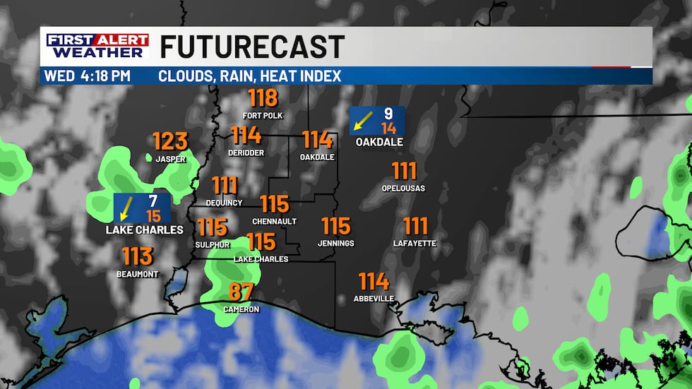
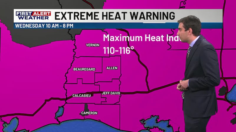
Before we get to Bertha, let’s talk about the heat. Obviously, it’s already been a hot couple of days, but the heat turns up a notch on Wednesday. In fact, actual high temperatures may approach 100 degrees if we see enough sunshine. The heat index easily could climb above 110 for some spots, possibly topping out in the 110-116 degree range.
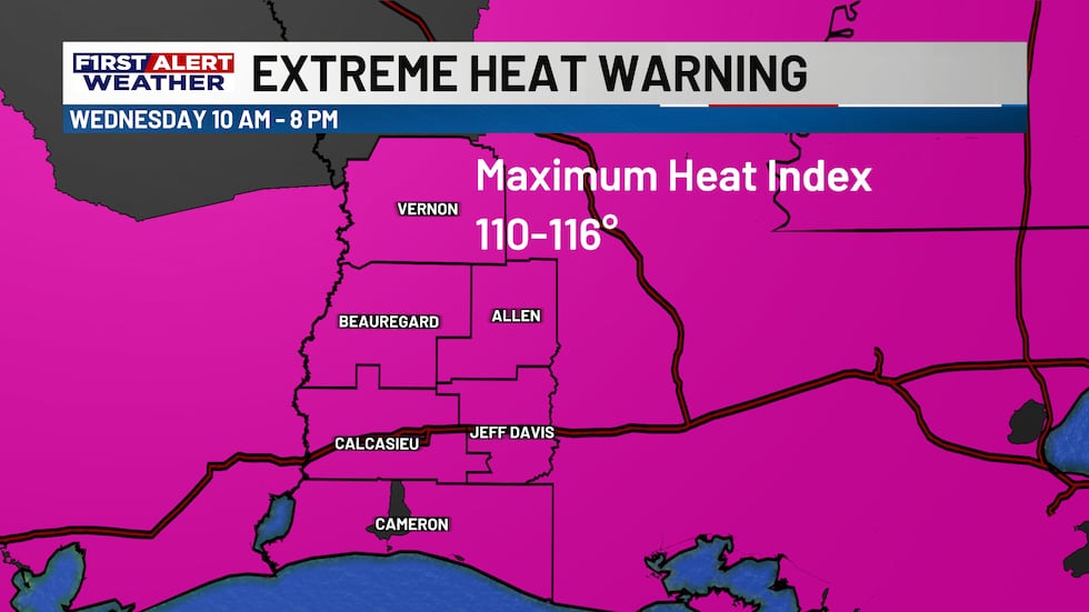
This is particularly hazardous for any outdoor activities and is the reason why an Extreme Heat Warning has been issued for SWLA Wednesday between 10 AM - 8 PM. It will be best to remain indoors if you can. If you must be outside, take frequent breaks, stay hydrated and find as much shade as you can. If you feel yourself starting to overheat, that’s the cue to head indoors. There could also be a couple pop-up storms in the afternoon as Bertha approaches. If we see any, the heat and humidity could cause them to become strong.
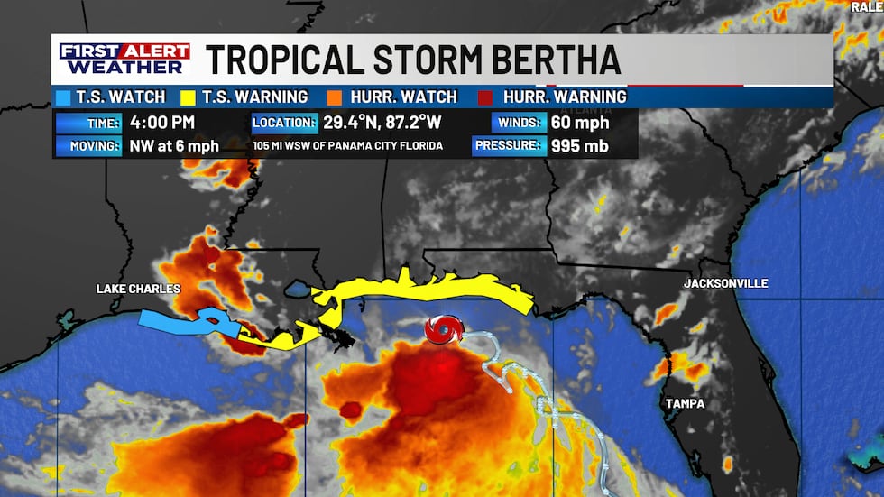
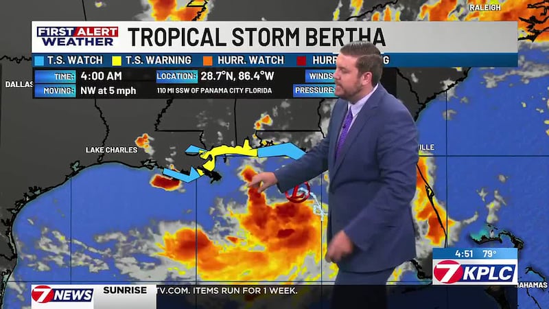
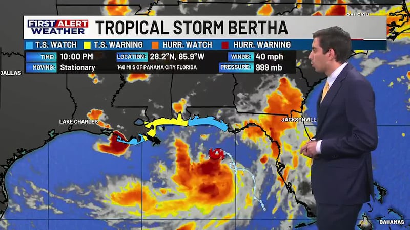
Tropical Storm Bertha continues to move in a westerly direction toward the vicinity of southeast Louisiana and near New Orleans. As of this afternoon and evening the heaviest thunderstorm activity is south of the storm’s center due to strong wind shear, and that will be the case for the next couple days.
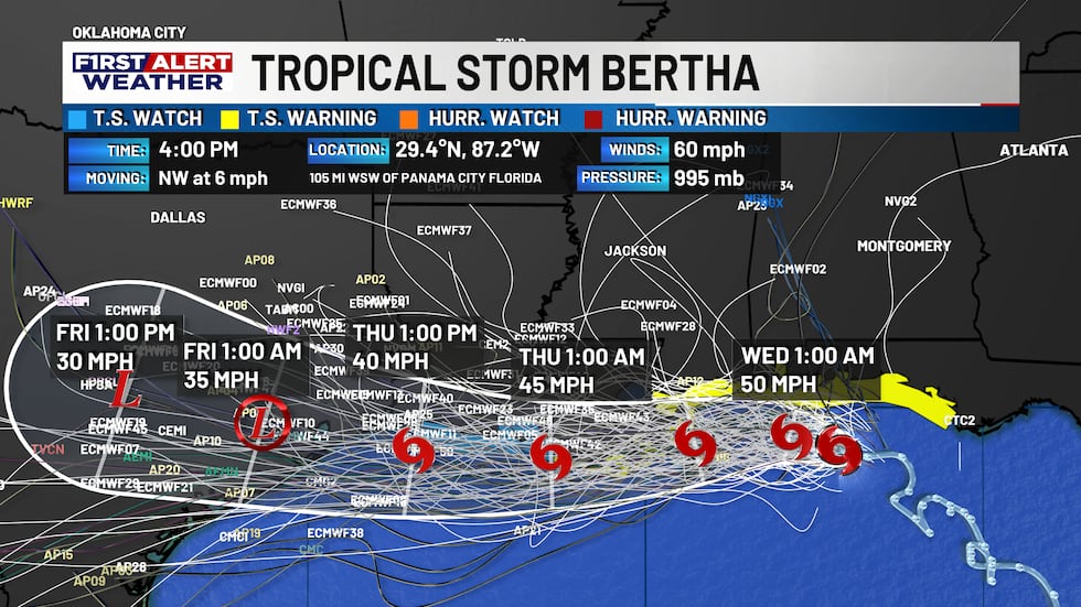
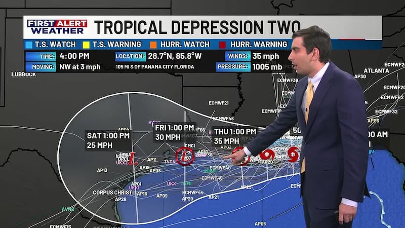
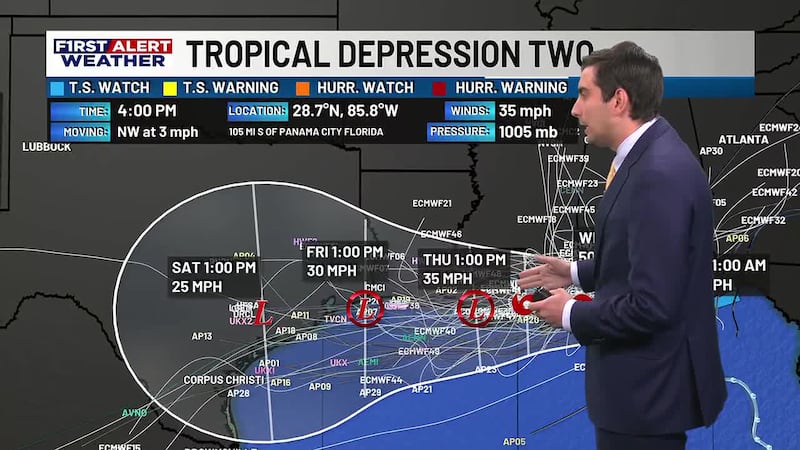
The official track shows Bertha approaching the New Orleans area tonight and moving close to the Cameron coast by tomorrow night into Thursday evening. The only change has been to add Tropical Storm Watches to Eastern Cameron Parish and to keep the center a little farther offshore of Cameron. While this means Bertha may be able to hold onto its’ tropical storm strength, that also means the heaviest storms likely will stay even farther offshore.
The next few days:
Wednesday Morning: Heat index values start in the 80s but will quickly warm up with partly cloudy skies and tropical air overhead. Any breaks of sunshine will rapidly heat things up.
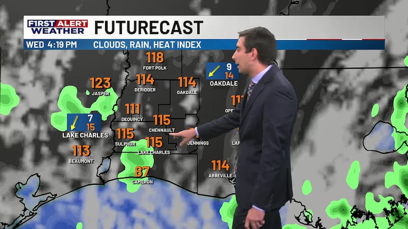
Wednesday Afternoon: Heat index near or above 110°, possibly reaching 115° at times. Mainly dry, but a couple of isolated pop-up showers or storms are possible. Any storms that do develop could be on the stronger side because of the heat.
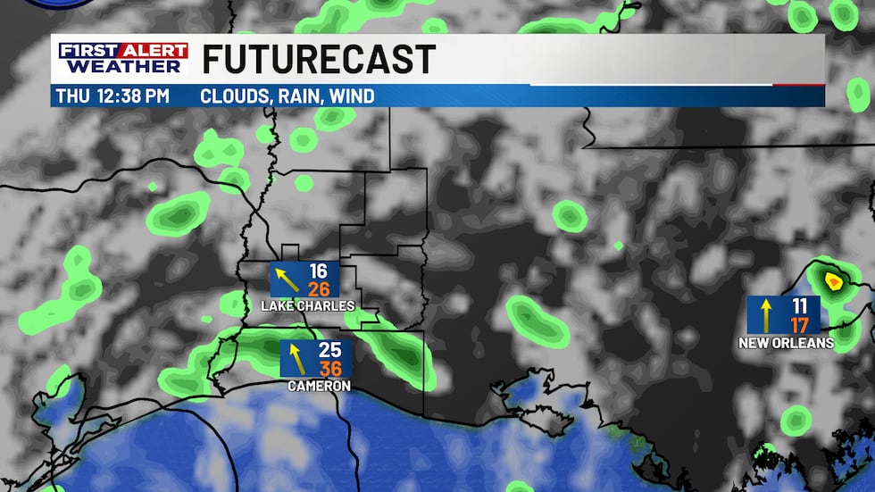
Thursday: A slight increase in rain chances as Bertha moves closer, but impacts remain limited. Isolated to scattered storms are possible, as well as some breezy weather near the coast and possibly elevated tides. But again, the the heaviest weather stays offshore.
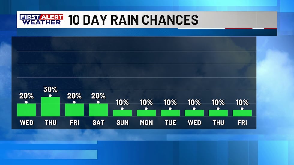
Friday into the weekend: This is when some “relief” arrives. as Temperatures drop to the low-to-mid 90s. Some isolated showers and storms can’t be ruled out, but overall rain coverages again looks pretty limited, unless some remnant tropical moisture can hold on a little longer We’ll watch this over the next few days.
Copyright 2026 KPLC. All rights reserved.