First Alert Forecast: Morning showers slowly taper into the afternoon, cooler weather to end the week
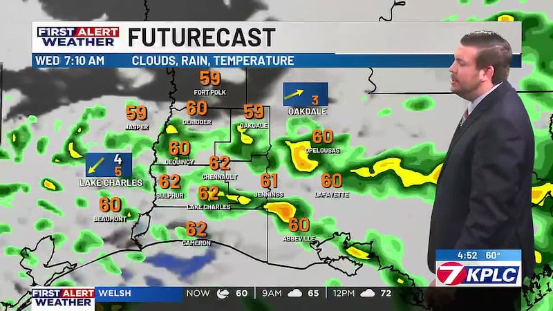
Meteorologist Jacob Durham is breaking down the latest on rain chances this morning and our big cool down.
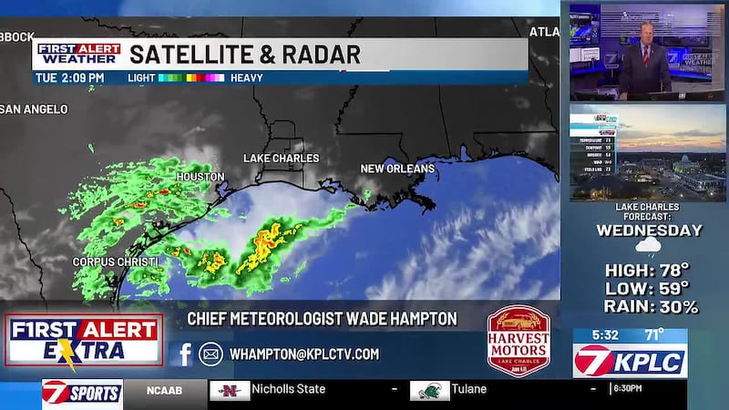
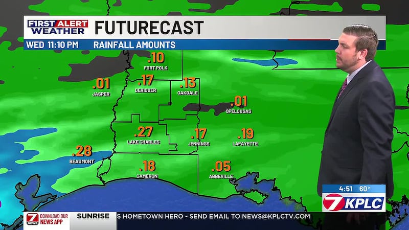
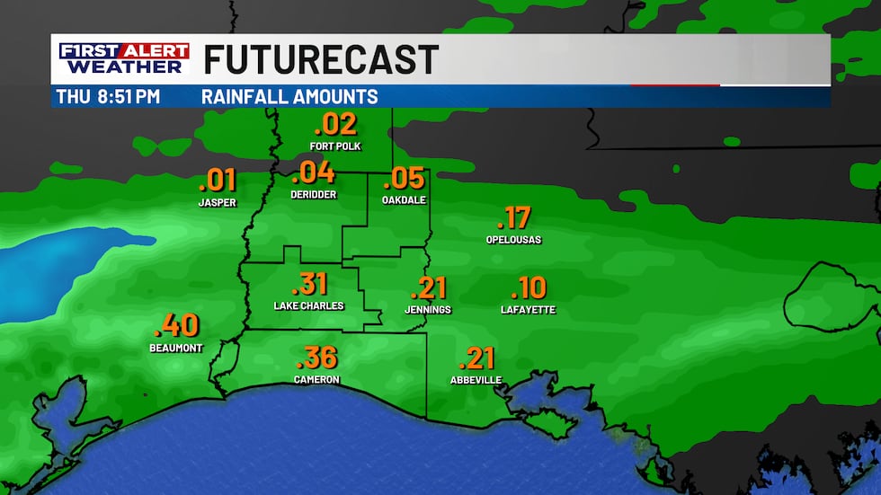
LAKE CHARLES, La. (KPLC) - Make sure to grab the rain jacket and umbrella as you head out the door this morning as scattered showers and downpours push through.
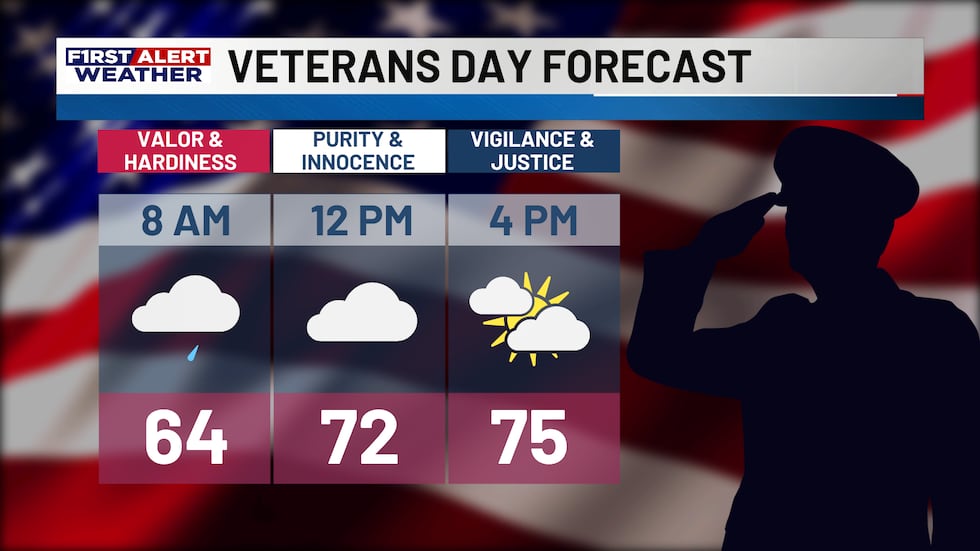
The more widespread rain is certainly along and south of I-10 this morning, with spottier coverage for inland zones.
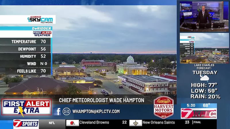
Temperatures are into the lower 60s to start the day, but thanks to some late day clearing and sunshine most areas should reach the middle to upper 70s by afternoon.
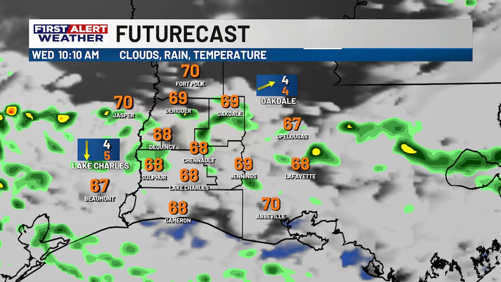
If you are heading out to any Veterans Day events, keep the rain gear with you through mid-morning before the showers and downpours slide eastward.
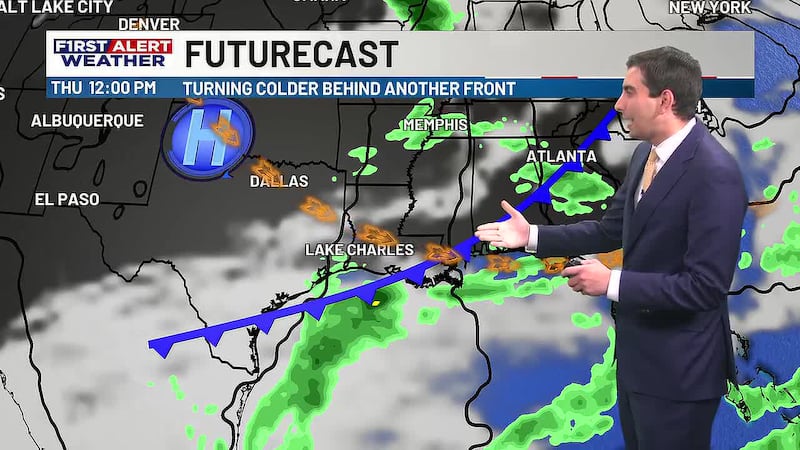
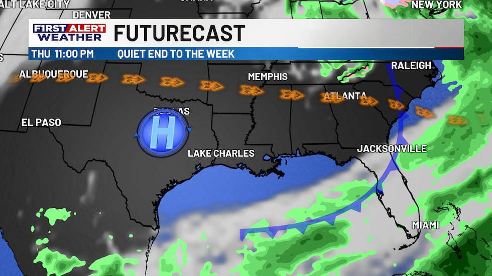
Quiet weather is settling in for Thursday as more sunshine returns, but also some gusty winds as we await the arrival of a second frontal boundary.
Unlike the one bringing rain and downpours this morning, the second front is featuring drier conditions with a drop in temperatures instead.
It’ll be time to grab the jackets and coats as temperatures during the morning hours return to the middle and upper 40s for most starting Friday and continue through Sunday morning.
Afternoons will also be cooler as highs are struggling to each the lower 70s for Saturday and Sunday.
The one good thing is we are looking at plenty of sunshine and dry conditions for the first round of the high school football playoffs.
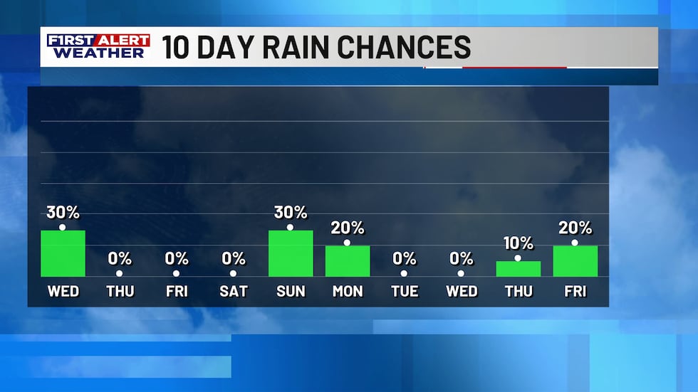
We will be watching another system to arrive late Sunday into Monday, which is trending a little more unsettled this morning.
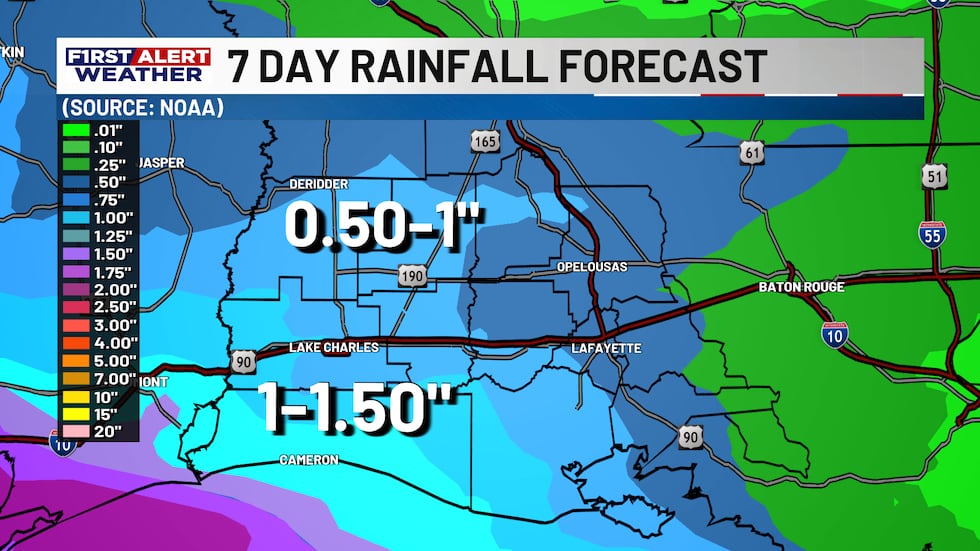
Another round of showers and maybe a few storms looks possible late Sunday into Monday before bringing another dip in temperatures next week.
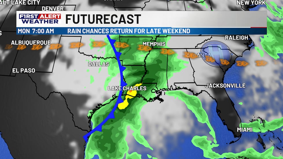
This will be something we are watching closely for those weekend plans to end Sunday, but Saturday will certainly be the pick of the weekend, it’ll just be chilly with highs in the upper 60s to near 70.
Drier weather looks to return for much of next week with highs moderating closer to normal in the lower and middle 70s with overnight temperatures into the lower and middle 50s.
Tropics are staying quiet as well as we are in the final stretch of the 2026 Hurricane Season.
Makes sure to keep the KPLC First Alert Weather App handy as we break down rain this morning as the cooler weather to end the week.
Copyright 2026 KPLC. All rights reserved.