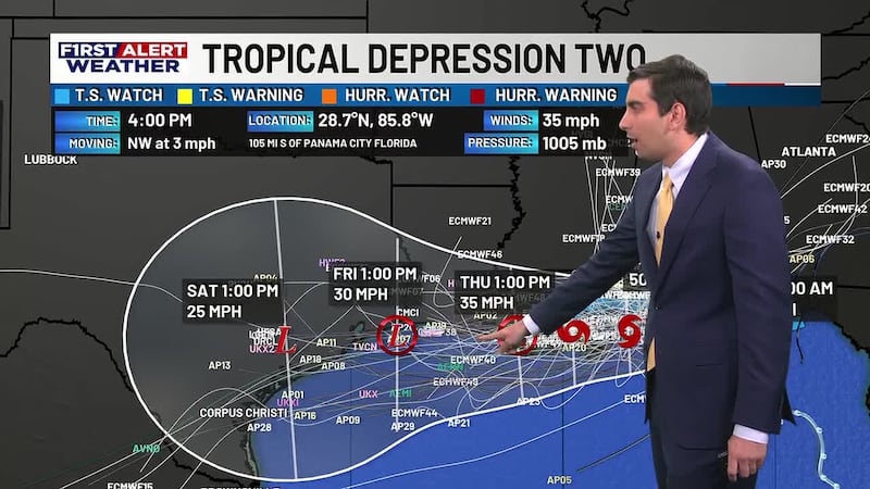
First Alert Forecast: Extreme heat for our Wednesday, as we continue to monitor Tropical Storm Bertha
Meteorologist Jacob Durham is breaking down the latest on the hottest day of the week as well as impacts Bertha could bring.
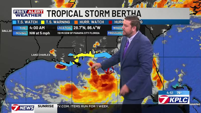
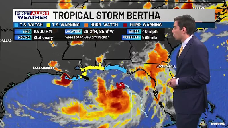
LAKE CHARLES, La. (KPLC) - We are continuing to keep a close watch on Tropical Storm Bertha as it nears Southeast Louisiana later today, but also dangerous heat here in SWLA.
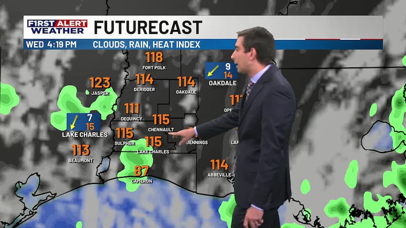
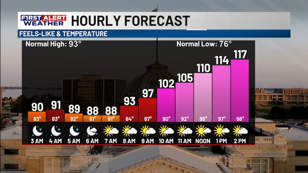
Temperatures will quickly climb as we head into our Wednesday as we are starting off with mostly sunny skies.
Most areas are heading into the upper 90s to near 100° as drier air in the upper level keeps things mostly quiet.
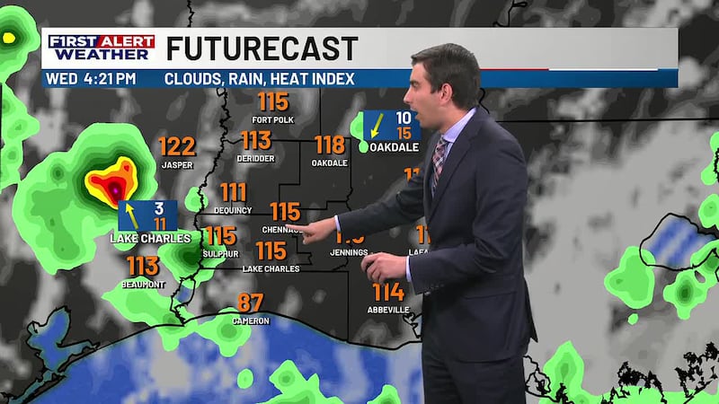
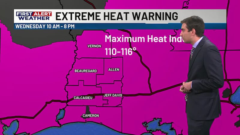
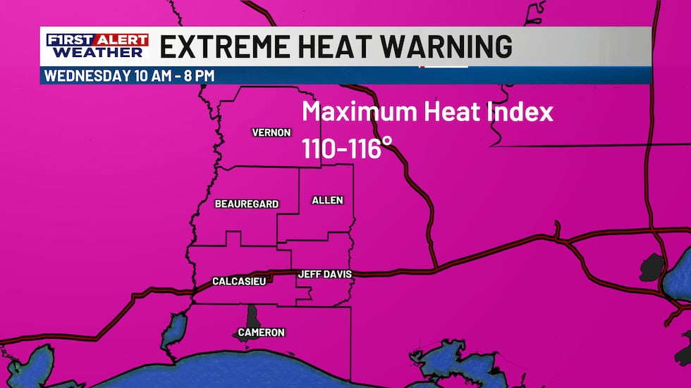
An Extreme Heat Warning is in place for all of SWLA as heat indices are climbing between 110-116°, so it will be important to drink plenty of water as well as stay cool and hydrated.
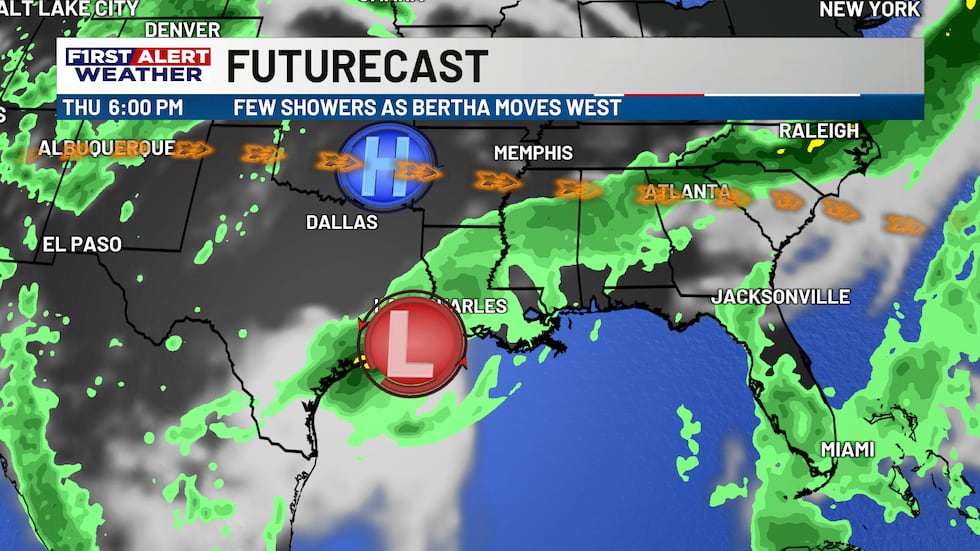
Cloud cover will slowly build as we head into the afternoon and evening hours as Bertha slowly pushes farther west.
A couple of spotty to isolated showers and storms will be possible as we head into the evening hours, especially for locations closer to the I-10 corridor.
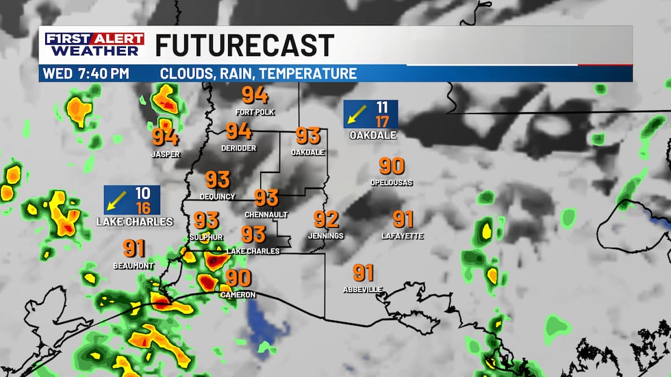
Rain will continue to remain isolated to scattered heading into Thursday as well with Bertha making its closest approach to the region.
A Tropical Storm Watch is in place for the eastern half of Cameron Parish as the system is expected to weaken the more westward it travels as wind shear and dry air continue to tear the storm apart.
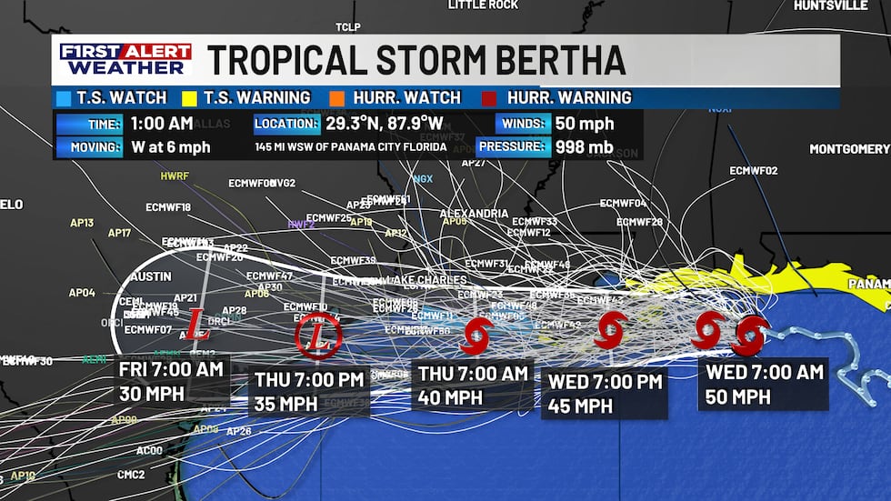
Expect some squally weather at times along the coastline however, as we could see wind gust nearing 40 mph in some of the tropical bands.
For the rest of us, some gust closer to 20-30 mph will be possible along the I-10 corridor with lighter winds inland.
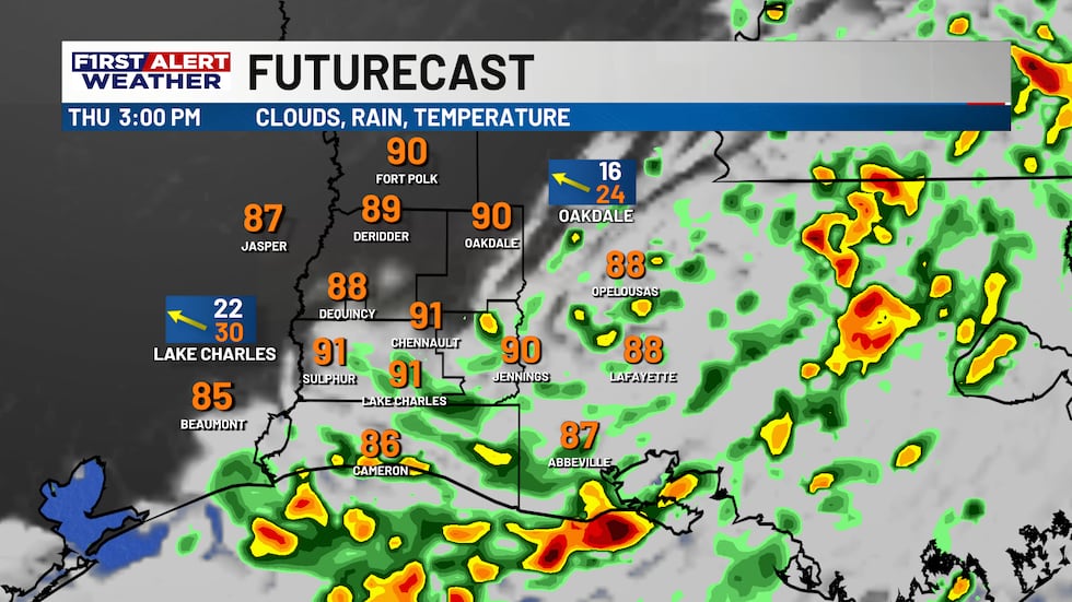
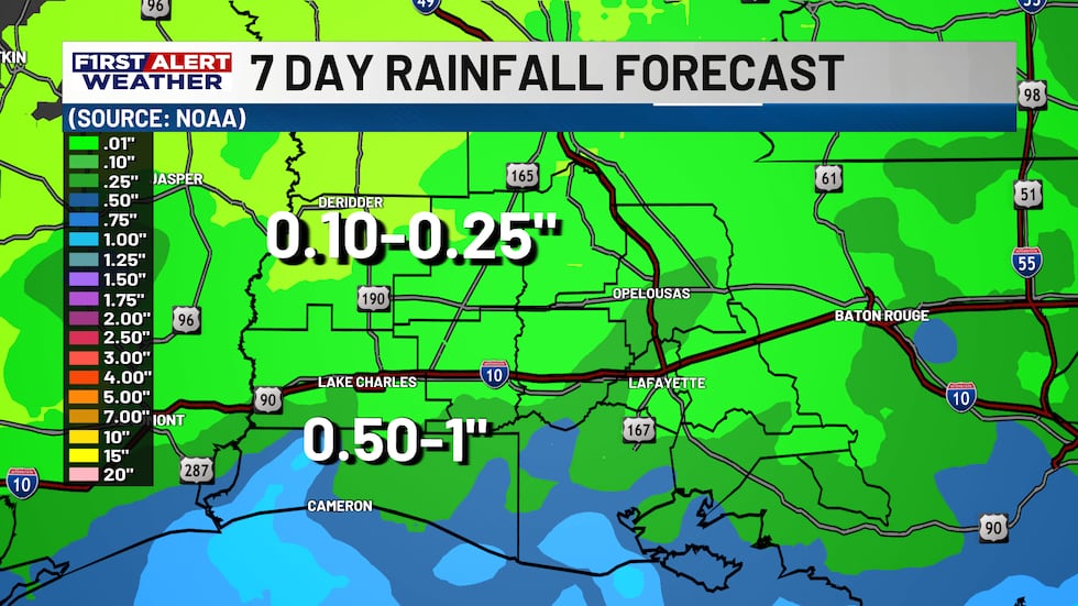
As for rain totals, they will remain light as well with most areas receiving less than a half inch by thee time the storm moves into Texas Friday.
Drier and warmer weather are expected to return for the weekend, so if you have any outdoor plans, the forecast is looking better for those as well!
Highs will remain steady in the middle 90s Saturday and Sunday before we return to the upper 90s by the middle half of next week.
We’ll continue to keep a close watch on the latest with Bertha as it slides to the west, but we will also monitor the dangerous heat as well, which will be more impactful for everyone.
As always, you can find the latest forecast and information inside your KPLC First Alert Weather App.
Copyright 2026 KPLC. All rights reserved.